Believe the sky to be your canvas, on which you may paint landscapes from above. Leonardo da Vinci famously remarked, ‘For once you have tasted flight, you will forever walk the earth with your eyes turned skyward’. We’re not talking about developing wings anymore, but rather something equally miraculous that is drones. Drones are the artists of the skies in this high-tech era, and they’re not just for producing amazing photos and films. They are the best tools for mapping our environment from above, and we are about to explore the world of the best mapping drone.
These remarkable machines have transformed the way we examine, explore, and comprehend our planet. So buckle in, because we’re about to set on a tour through the skies, guided by drones that are modern-day mapping and precision explorers. Let us explore the sky and land with our sights set on the future of mapping.
What will you see here?
DJI Matrice 300 RTK
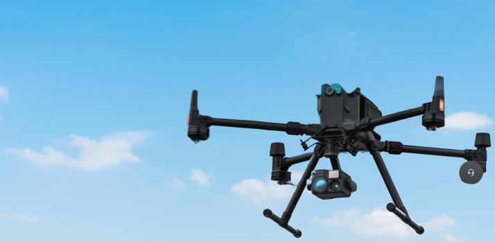
The DJI Matrice 300 RTK is the mapping drone equivalent of a superhero! It has some extremely amazing features that set it apart. To begin with, it has a flight time of 55 minutes on a single charge. That's about an hour in the air, allowing you to explore and map wider areas without fear of the battery dying mid-flight. The DJI Matrice 300 RTK is an incredible piece of technology, but the price reflects its capabilities. The base model is priced at huge fat prices making it an excellent investment for those wishing to up their drone game. But hold on, there's more! If you choose the DJI Smart Controller Enterprise, the cost rises further. This controller provides an additional degree of convenience and control that is worth considering.
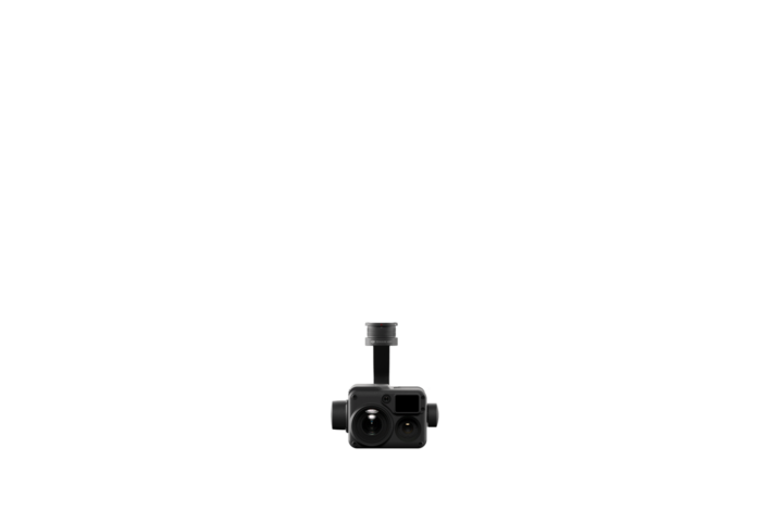
And in terms of range, this drone is unrivaled. It can travel up to 15 kilometers! That's equivalent to mapping an entire city without leaving your desk. Just remember to keep it visible for safety. Do you require speed? That is also covered by the Matrice 300. It can move through the air at a speed of 23 meters per second. So, if you need to map a large region quickly, this drone is your greatest friend. It's not a small drone; it weighs 3.6 kilograms and has dimensions of 810x670x430 millimeters. So it's more for serious commercial work than for fun. However, if you want the greatest mapping drone available, the Matrice 300 RTK is the way to go. This drone's camera is also rather impressive. It has a 960p resolution, a broad 145° field of view, and a frame rate of 30 frames per second. It's also really sturdy, so you won't get shaky footage.
While the Matrice 300 RTK may appear to be a significant investment, keep in mind that it is a high-end mapping drone with features that cater to a variety of professional applications such as construction, surveying, and inspection.
Sensefly eBee X
The eBee X is a lightweight mapping marvel built for broad coverage and razor-sharp data. With a flight time of 90 minutes, it's a mapping powerhouse with RTK and PPK capabilities, as well as online training and eMotion flight planning software for seamless operation. The NDAA compliance of the eBee X distinguishes it, allowing professional mapping operations such as flying securely over people and beyond visual line of sight (BVLOS). It is suitable for varied mapping purposes because it is equipped with 3D, RGB, multispectral, and thermal cameras.
The eBee X is all about precision, with a remarkable 1.5 cm / 0.6 in absolute accuracy, even without ground control points (GCPs). Weighing just 1.6 kg / 3.6 lbs at takeoff, it complies with various regulations, making BVLOS and flights over people more accessible. What's more, the eBee X is a true energy-efficient champion, offering 90 minutes of flight time, allowing you to efficiently map up to 500 hectares at 120 meters. It's shock absorbent and equipped with Remote ID, C2, and C6 capabilities for safety.
But that's not all as the eBee X is also user-friendly, making mapping a breeze. Its eMotion flight planning program is suited for beginners while also providing advanced functionality for addressing the most difficult assignments. It's a smarter approach to mapping that ensures high-quality, efficient, and safe data capture.
DJI Phantom 4 RTK
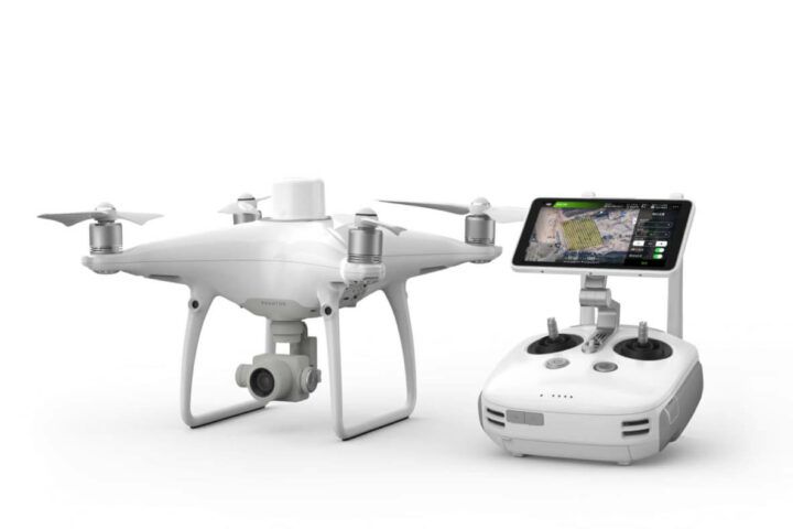
The DJI Phantom 4 RTK is a high-quality mapping drone built for professionals who require precision. Its integrated RTK module provides extremely accurate location down to centimeters. As a result, it is an excellent choice for surveying and mapping jobs. Let's have a look at its main features. The Phantom 4 RTK has a 30-minute flight time, which is more than enough for most mapping jobs. Extra batteries are available if you require more airtime. The drone has a robust 7-kilometer range that can be extended if necessary. It is not scared of difficult settings, such as flying over water or dense woodlands.
With a top speed of 36 mph, you'll be able to cover a lot of ground quickly. The camera is a star since it has a 1" CMOS sensor that captures 20-megapixel photos. It records 4K video at 60 frames per second and 1080p video at 120 frames per second, providing clear images from the sky. It's compact and lightweight, fitting into most cars and being easy to carry for most individuals.
In a word, the DJI Phantom 4 RTK is a great option for mapping experts. It is dependable, captures high-quality data with precision, and is reasonably simple to use. Just keep in mind that this degree of quality comes with a high cost, and if you require heavy lifting skills, you may want to look into alternative possibilities.
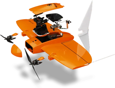
WingtraOne Gen II
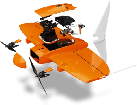
The WingtraOne GEN II is a drone that brings reliability and mapping capabilities to new heights. This drone is all about making your work easier by ensuring that it runs smoothly. The WingtraOne GEN II is distinguished by its dependability on the job site. It has clever algorithms that constantly check all important aircraft components before and during missions. This means you get predictive maintenance, which alerts you to possible concerns before they become major difficulties. It's like having a self-protecting drone! The crew behind this drone has worked tirelessly for six years to perfect it. Over 40 software updates have been made, and over 100,000 successful user flights have occurred, ensuring that it is a top performer.
The built-in PPK (Post-Processed Kinematic) GNSS receiver is a notable feature. That implies there's no requirement for ground control points (GCPs) to attain centimeter-level precision. Precision is guaranteed whether mapping or landing. The WingtraOne is a tailsitter vertical take-off and landing (VTOL) drone that weighs 3.7 kg and has a maximum payload of 800 g. It has a 125 cm wingspan and is powered by two 99 Wh batteries. The radio link enables communication up to 10 km in a direct line of sight. It includes WingtraPilot, a powerful flight planning and mission control software, as well as a water and dust-resistant Samsung Galaxy tablet.
In short, the WingtraOne GEN II is a dependable and advanced mapping and surveying drone. Its predictive maintenance skills, PPK capabilities, and smart design make it an invaluable tool for professionals who require precision and efficiency.
DJI Mavic 3
The DJI Mavic 3 Cine is a wonderful drone that raises the bar for aerial photography and videography. Imagine being able to snap amazing photographs and shoot videos at 5.1K quality - that's the degree of detail this drone provides. With a flying period of up to 46 minutes, you'll have plenty of time to explore the skies and get the ideal photo. Its impressive 15 km range allows you to travel long distances, and its top speed of 19 m/s allows you to cover ground swiftly. The professional-grade 4/3 CMOS camera, with 20 MP effective pixels and an 84° field of view, is one of its notable features.
It's a versatile instrument for capturing high-quality photographs and films for a variety of uses. Despite its amazing powers, it is a rather little device, measuring 347.5283107.7 mm in length and weighing 899g. The price tag, on the other hand, may give potential users pause. It costs money to achieve this level of quality and performance. Furthermore, negotiating the intricate web of drone rules in various regions might be difficult, and the Mavic 3 Cine may not be the lightest drone on the market.
In conclusion, the DJI Mavic 3 Cine is an excellent drone for individuals who expect the best in aerial photography and videography. Its remarkable camera capabilities and impressive flight characteristics make it a strong tool for pros, but the price and potential regulatory difficulties must be considered.
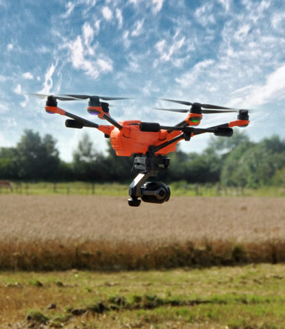
Yuneec H520
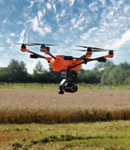
The Yuneec H520E is a high-end hexacopter intended for professionals. It ensures stability and reliability in industrial applications with continuous gimbal rotation of up to 330° and a 5-rotor fail-safe system. Depending on payload weight, it can fly for up to 28 minutes. With hot-swappable cameras, retractable landing gear, and an integrated 7-inch touch screen on the ST16S/E Ground Station, this drone is a versatile powerhouse. DataPilotTM allows you to remotely control the camera settings and plan missions. It has a radio communication range of 3 kilometers. The H520E, which will be available in November 2020, is Yuneec's latest hexacopter solution, featuring extended range, powerful computational power, precise navigation, and reliability. With a six-rotor system, long focal-length lenses for distant flights, and quick data transmission in high-quality video or photos, it's designed for industrial use, particularly inspections.
Even in adverse weather, it maintains stable flight with accurate control and retractable landing gear for unhindered data collection. There are other commercial service bundles available. The H520E is distinguished by the fact that your data remains under your control; there is no automatic data transfer to external servers. The H520E streamlines difficult jobs while keeping your data secure and operations efficient, thanks to features like Orbit Flight for circular flights, hot-swappable cameras, and the all-in-one ST16S/E controller with a 7-inch screen. It's an excellent choice for ambitious professionals looking for a reliable aerial workhorse.
How do drones navigate and avoid obstacles?
Drones use a variety of technology and sensors to navigate and avoid obstacles. GPS gives position information, IMUs maintain stability, barometers calculate altitude, and compasses provide heading information. Obstacle avoidance sensors identify obstacles in the path of the drone using signals, whilst computer vision, Lidar, and AI enable intelligent obstacle recognition and decision-making. This combination of capabilities enables drones to navigate various settings while avoiding collisions, making them versatile and safe for a wide range of applications.
Are there privacy concerns with drones?
Yes, there are privacy problems with drones because of their potential to take photographs and videos from the air. Drones can unwittingly invade people’s privacy, particularly when used for surveillance or photography. This has sparked discussions about legislation and privacy laws aimed at protecting personal privacy while assuring ethical drone use. In the age of drones, striking a balance between technological progress and privacy rights is a constant issue.
Conclusion
We’ve explored a sky packed with technological marvels in the field of mapping drones. The DJI Matrice 300 RTK soars with outstanding range and longer flight periods. The H520E from Yuneec is a professional-grade hexacopter that is suited for precision missions. The eBee X provides razor-sharp data as well as BVLOS capabilities. The precision of DJI’s Phantom 4 RTK is unrivaled, while the WingtraOne GEN II assures dependability and predictive maintenance. The Mavic 3 Cine captures the skies in an amazing 5.1K resolution, while Yuneec’s H520 is ideal for professional applications. With these drones, charting the Earth becomes an art form, despite the complexities and costs involved. Take to the sky with your mapping masterpiece!
Read More
- DJI mini 2: Best Drone in a league of its own!
- Try these steps if your Sky Go App is not working!
- Samsung Galaxy S21 Review-Samsung’s top-notch powerful smartphone!
- The Best Camera Drones in 2025: Take your Best Photographs and Videos in the Sky!
- Breville Precision Brewer: Specially built for coffee consumers to get that perfect cup!

